7 Essential Steps to Find the Perfect Water Well Location
Finding the right spot for a water well ensures a dependable water supply, protects against contamination, and reduces long-term costs. Here’s a quick overview of the steps:
- Check Water Availability: Study groundwater levels and geological formations like sand or fractured rock for easier access.
- Read Geology Reports: Use resources like USGS maps or state surveys to identify water-bearing zones.
- Check Local Rules: Follow setback distances and zoning laws to avoid fines or contamination risks.
- Find Safety Hazards: Assess nearby risks like septic tanks, flood zones, or agricultural runoff.
- Plan for Access: Ensure proper roads and clearance for drilling and maintenance equipment.
- Work with Experts: Hire hydrogeologists and licensed contractors for detailed site assessments.
- Use Modern Tools: Leverage digital mapping, underground imaging, and flow analysis for precise well placement.
Quick Tip: Combine expert advice with modern tools to make informed decisions and avoid costly mistakes.
Where to Drill a Well on Your Property
Step 1: Check Water Availability
Before drilling a well, it's essential to determine if your area has enough groundwater to meet your needs. Knowing local groundwater conditions helps you avoid costly mistakes and ensures a dependable water source.
Local Groundwater Basics
Groundwater availability depends largely on the type of geological formations in your area. Porous materials like sand and gravel make water easier to access, while dense rocks often require deeper drilling. Natural signs like springs, wetlands, lush vegetation, or nearby water bodies can hint at promising well locations [1].
| Rock/Soil Type | Water Availability | Drilling Complexity |
|---|---|---|
| Sand and Gravel | High | Low |
| Sedimentary Rock | Moderate to High | Moderate |
| Dense Rock | Low | High |
| Fractured Rock | Variable | Moderate |
Table comparing groundwater availability and drilling complexity by rock/soil type.
Water Detection Methods
Modern tools make locating groundwater more precise. Techniques like underground imaging (ERT), hydrogeological mapping, and hydrochemical analysis provide detailed insights into groundwater availability, quality, and aquifer characteristics. These methods create detailed site assessments to guide drilling decisions [4].
Hydrogeological mapping tools can provide:
- Information on local well depths
- Analysis of data from existing wells
- Comprehensive site surveys
"Areas with fractured rock formations or porous sedimentary rocks are more likely to have accessible groundwater" [4].
Using a combination of these detection methods and consulting local experts can help you identify the best location for your well. By understanding your area's groundwater conditions and leveraging advanced tools, you set the stage for a reliable and efficient well site.
After evaluating groundwater availability, the next step is to consult geological reports for a deeper understanding of your site's potential.
Step 2: Read Geology Reports
Geology reports are key to understanding underground formations, helping you choose the best spots for drilling and avoid costly errors. These reports highlight water-bearing zones and guide you toward better decision-making.
Where to Find Geology Data
You can access geological data from trusted sources like the USGS National Geologic Map Database, state geological surveys, and county hydrogeological reports. Many of these resources are available online, making it easier to research potential well sites.
| Data Source | Information Provided |
|---|---|
| USGS Maps | Details on rock formations, fault lines |
| State Geological Surveys | Aquifer data, well logs, and local geology |
| Hydrogeological Reports | Water table depth, flow patterns |
Identifying Promising Well Locations
Geological reports can help you zero in on areas with the best water potential while avoiding unsuitable spots. Tools like radar and tomography can complement traditional mapping techniques, offering deeper insights.
| Geological Feature | Water Potential |
|---|---|
| Sedimentary Aquifers | High |
| Fractured Bedrock | Moderate |
| Alluvial Deposits | Very High |
Pay close attention to features like aquifers, water-bearing fractures, and areas with a history of successful wells. These are strong indicators of where to drill. Once you've identified a promising spot, make sure it aligns with local regulations and zoning laws to avoid complications later.
Step 3: Check Local Rules
Local rules are in place to protect public health and natural resources while ensuring your well project complies with legal standards.
Well Drilling Rules
Setback distances are crucial to prevent contamination. For example, wells must be at least 50 feet away from septic tanks and 100 feet from fuel storage areas. Ignoring these rules can lead to fines, forced well closures, or costly relocations.
| Feature | Minimum Required Distance |
|---|---|
| Septic Tanks | 50 feet |
| Fuel Storage Areas | 100 feet |
| Pesticide Application Sites | 100 feet |
| Property Lines | Varies by jurisdiction |
| Agricultural Runoff Areas | Site-specific assessment required |
Hiring licensed well contractors is key. They know these regulations inside and out and can help you stay within the rules.
Property Zoning Laws
Zoning laws can impact where and how you construct a well. Some areas, like wellhead protection zones or groundwater recharge regions, may require special permits or environmental reviews.
Reach out to your local planning department to confirm zoning classifications and any necessary permits. While online tools can help with preliminary research, always double-check your findings with official sources.
"Environmental considerations are crucial in well drilling regulations to protect natural resources and prevent contamination. Regulations often require assessments to ensure that well drilling does not harm local ecosystems or water quality[1][6]."
Step 4: Find Safety Hazards
Ensuring a safe and reliable well starts with identifying potential safety hazards. According to EPA data, about 20% of private wells contain contaminants that exceed health standards [5]. This makes a thorough hazard assessment a critical part of selecting the right well site.
Identify Nearby Risks
Take a close look at your property to spot possible contamination sources. Pay attention to:
| Risk Category | Potential Hazards | Assessment Tools |
|---|---|---|
| Human Activity | Industrial chemicals, septic systems, fuel tanks | Environmental records, property maps |
| Agricultural | Pesticides, fertilizers, animal waste | Land use history, soil testing |
| Natural Features | Flood zones, surface water, erosion | Topographic maps, flood data |
Don’t just focus on current risks - past land use can also leave behind contaminants. Tools like the Groundwater Occurrence and Depth (GOD) index can help evaluate the site’s vulnerability to contamination [7].
Maintain Safety Distances
While Step 3 covered basic safety distances, some contamination sources require extra precautions:
| Source Type | Key Considerations |
|---|---|
| Historical Sites | Investigate any past industrial or agricultural use |
| Natural Hazards | Review flood plains and drainage patterns |
| Seasonal Changes | Account for water table fluctuations during different times of the year |
"Environmental considerations are crucial in well drilling regulations to protect natural resources and prevent contamination. Regular safety assessments should be conducted to ensure ongoing well safety, including periodic inspections of the well and surrounding areas, testing for contaminants, and updating safety plans as necessary" [1][2].
If your property has complex geological features, it’s a good idea to consult a hydrogeologist for a detailed risk evaluation. Use recommended safety distances as a baseline, but increase them whenever possible for added protection.
Once you’ve addressed potential hazards, the next step is to ensure the well location is accessible for drilling equipment and future maintenance.
sbb-itb-e9f00dc
Step 5: Plan for Access
Making sure your well is accessible is key to keeping it functional for years to come. A well-thought-out access plan not only makes maintenance easier but also protects your investment in a reliable water supply.
Equipment Access
Drilling and maintaining a well require heavy-duty service vehicles and equipment. To accommodate them, keep the following in mind:
| Access Component | Requirements |
|---|---|
| Access Road Width | 12-20 feet |
| Ground Stability | Must support vehicles over 20 tons with a reinforced surface |
| Turning Radius | 40-50 feet |
| Overhead Clearance | 20-25 feet |
"Equipment access is not just about initial drilling - it's about ensuring decades of reliable maintenance" [1].
Future Property Changes
Think ahead about how changes to your property could impact well access. Here are some common considerations and strategies:
| Consideration | Strategy |
|---|---|
| Property Expansions | Maintain a buffer zone of at least 100 feet |
| Landscaping | Plan ahead for gardens and hardscaping features |
| Utilities | Account for future infrastructure updates |
| Access Routes | Design roads with potential modifications in mind |
Using mapping tools can help you visualize access routes and anticipate future changes. Pay attention to factors like:
- Planned building expansions
- Utility system updates
- Shifts in the natural landscape
- Year-round access for maintenance vehicles
Collaborating with professionals can ensure your access plan is practical and aligns with your long-term needs. A little foresight now can save you a lot of hassle down the road.
Step 6: Work with Experts
Previous steps help you gather the basics, but experts bring the technical know-how to turn that information into a workable plan.
Why Experts Are Essential
Experts bring the skills and tools needed to plan and build a well that’s both efficient and reliable. Here’s what their expertise can offer:
| Expert Service | What They Provide |
|---|---|
| Hydrogeological Assessment | In-depth look at aquifer layers and water quality |
| Site Evaluation | Review of terrain, access, and regulatory factors |
| Technical Planning | Recommendations for well depth and construction |
According to the Rural Community Assistance Corporation (RCAC), professional assessments can uncover potential risks and offer tailored solutions to improve the safety and reliability of your water source [9].
Finding the Right Professionals
Look for experts who handle everything from initial analysis to final construction. Here are the key services they should provide:
| Service Type | What It Includes |
|---|---|
| Geological and Hydrochemical Analysis | Mapping formations and checking water quality |
| Site Planning | Strategizing access routes and equipment placement |
| Installation Services | Proper drilling and well construction |
Hydrogeologists use advanced tools to evaluate underground conditions and identify the best spots for drilling [4]. Make sure to hire licensed professionals with local experience and solid client reviews.
Once you’ve tapped into expert advice, you can move on to exploring modern tools that enhance your well-planning process.
Step 7: Use Modern Tools
Modern tools bring a level of precision to well location planning that wasn't possible with older methods. By combining advanced technology with traditional approaches, finding the right spot for a well has become more accurate and dependable.
Water Well Map Guide
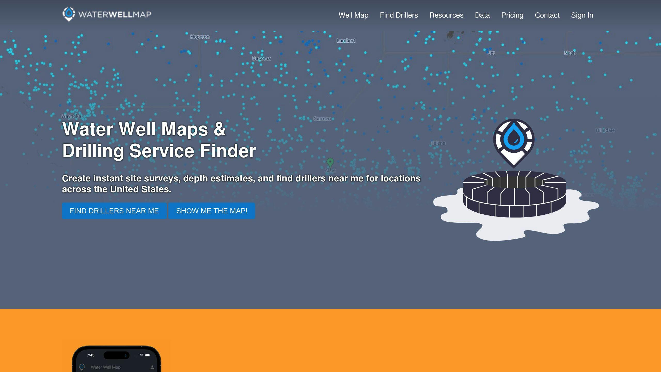
The Water Well Map is an interactive platform that provides well data, depth estimates, and connections to professionals in the field. It allows users to visualize existing wells nearby and generate detailed site reports. For those needing more in-depth information, the platform offers a Premium Plan at $24.99/month.
Digital Mapping Tools
Groundwater detection has taken a leap forward with cutting-edge digital mapping tools. These tools use satellite imagery, underground scans, and advanced data analysis to pinpoint groundwater locations and understand flow patterns.
Here are some key technologies:
| Technology Type | Benefit |
|---|---|
| Advanced Water Detection | Identifies exact water sources |
| Underground Mapping | Visualizes aquifers in detail |
| Flow Analysis Tools | Tracks water movement |
These tools also integrate with the EPA's WHPA Code, helping assess groundwater flow and potential contamination risks [10]. When used by professionals, they greatly improve the chances of successful well placement.
"The PMR method offers rapid and precise detection of groundwater by measuring signals emitted by hydrogen atoms in water molecules, providing unprecedented accuracy in well location selection" [11].
Conclusion
Choosing the right location for a water well involves weighing various factors and using a mix of older methods and newer technologies. A careful and detailed approach is key to ensuring a dependable water source.
Key Steps to Consider
Placing a well successfully involves assessing groundwater, following regulations, and seeking expert advice. When paired with modern tools, these steps can greatly boost placement accuracy.
Here's what the data highlights about effective well placement:
| Factor | Influence on Well Success |
|---|---|
| Groundwater Velocity | Changes significantly across regions |
| Protection Zone | Requires up to a 1,000-foot setback [8] |
| Assessment Techniques | Includes hydrogeological mapping and drilling tests |
Depth is another critical element in the process. While shallow wells are less expensive, they are more likely to experience water level changes [3]. Deeper wells, on the other hand, offer better protection against contamination and seasonal water shifts.
"The accuracy of wellhead protection areas can be significantly improved through numerical modeling, though this requires additional resources and expertise to implement effectively" [12].
FAQs
Here are answers to common questions to help you understand the key steps and factors involved in finding the right location for a water well.
How do I find a good spot for my water well?
Experts like hydrogeologists use tools such as groundwater models and hydrochemical analysis to study site conditions. These methods, paired with geological knowledge, help pinpoint the best areas for drilling. Using modern techniques makes it much easier to locate reliable groundwater zones [4].
"The accuracy of wellhead protection areas can be significantly improved through numerical modeling, though this requires additional resources and expertise to implement effectively" [12].
How do I choose a well location?
Selecting a well location involves considering safety, ease of access, and following local rules. Keep your well a safe distance from potential contamination sources like septic systems or fuel tanks to maintain water quality. Tools like Water Well Map can provide useful insights, including interactive maps and depth estimates, to help you decide.
How to decide where to drill a water well?
Drilling decisions rely on expert evaluations of geology, contamination risks, and accessibility. Advanced tools like digital maps and hydrogeological surveys make it easier to ensure the well's long-term reliability. Source water assessments are also essential for identifying any contamination risks [5]. Partnering with qualified professionals who use these tools and techniques gives you the best chance of success [3].